
Choosing the route
If you don’t have much time or are not particularly interested in designing a specific bikepacking route, you can use some of the already created ones. I am talking about the very classic bike-touring routes. Each of them has a dedicated website where you can find all the info.

The biggest European project of all is Eurovelo. This is a very extended network of routes and because of this, some sections are sometimes not finished. So you need to carefully gather information before leaving. I normally use Eurovelo to get ideas.
Then there are the historical routes. They are very popular so you can feel safer as you will be meeting other cyclists regularly. They are well organized so you can easily follow the instructions on their websites and the signs when out there. Here are some of the best ones I rode:
- Greenways: the main route leads from Prague to Vienna but there are also many other branching sections in other interesting places throughout Central Europe
- Elbe River: from the source of the Elbe River in Czechia all the way to the Northern Sea
- Danube cycle path: mostly in lovely Austria
- Alpe Adria: Amazing ride through the Alps from Salzburg to the Adriatic Sea
- Rheine: from Switzerland to the North Sea
- Via Claudia Augusta: the easiest way to cross the Alps

If you want to design your own custom trip, you will need to invest more time but it is great fun. I love the part when planning a bikepacking route and already travelling in my mind, feeling a sense of excitement and anticipation. Once I choose the general route, I start to dig deeper….
Planning the trip
Once I nail down the big idea, let’s say, bikepacking from Prague to Berlin, I start to collect information. To do this, I normally turn to websites like Koomoot, Bikemap or RidewithGps. There I get the general idea of the more common routes connecting Prague to Berlin and, most importantly, I check roads that are safer through heat maps, which is important when riding on asphalt.
Then I pick what I think is the best route for me as a starting point (normally based on the length and climbing sections) and I try to analyze it to find out if it meets my needs. Almost always it doesn’t because we are all different so I start to enrich it according to my personal taste.
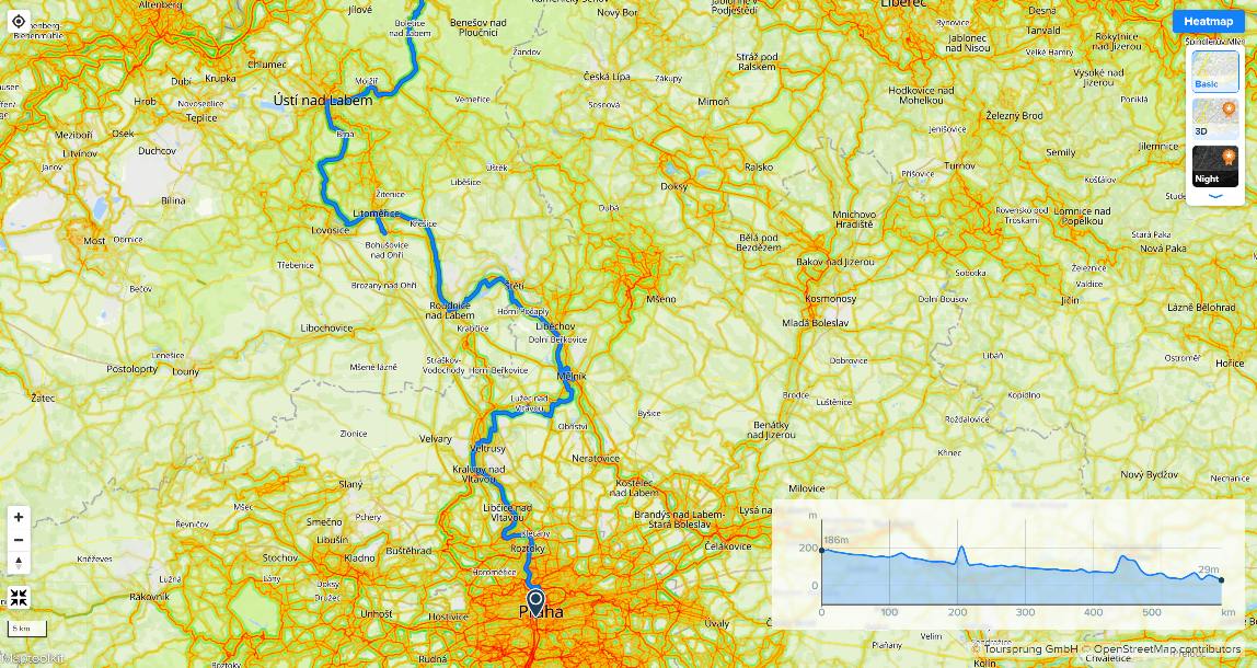
This means I start to look for highlights along the bikepacking route to make sure that I am not missing out. I use Google or Trip Advisor, for example, and I make a list of all the things that I believe are worthy of seeing. Castles, lakes, waterfalls. Once I have the list, I start to make sure that they are on the route I chose. If not, I modify it accordingly. Once I am done designing, I save the route, download the offline map of the area I am going to cycle through and later use it as navigation.
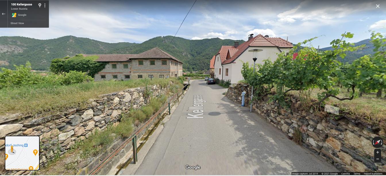
Once I nail down the general bikepacking route and the highlights, I start to polish it. For me, polishing means to have at least 50% of natural trails and roads with as little traffic as possible. To find natural trails, I use the contour lines on topographical maps, which help me not to choose trails that are too steep, hence a lot of pushing. To check for possible traffic, if I am not sure, I just use Google Street View. I drop the pin here and there and get a general idea of the road. If I see that it is narrow with just one lane and doesn’t have any shoulder, I look for alternatives.
Last resort, if I really cannot find the info I want, I just contact local cycling clubs and ask. People love to give advice about the hobby they are passionate about.
Extra tips
There are also some other amazing tools that I use regularly and would like to share with you.
I love to keep an eye on the weather in real time. There are some great apps/websites such as Windy. You can see how the rainfall is moving and plan accordingly – even checking the wind is very important sometimes. For example, when I was riding in Holland, I was planning my riding daily according to the wind.

If you want to share your position with your friends, wives, husbands, girlfriends, boyfriends or apprehensive parents, there are some really good options. I tried Neveralone first hand during a race and really loved it. When I go for long remote rides now, I always use it.
Every good trip starts with planning. Enjoy the process!


