1) Map and compass
Likely not worth including if you’re reading this article but the original method has to get a mention! Additionally, if you plan to go off-road, somewhere you don’t speak the language, where you know battery life will be short-lived (maybe if it’s cold or you’ve no battery pack) or signal will be patchy, it can help to have a map to fall back on which you know how to read and use.
2) Your phone
This is often the cheapest and simplest solution to mapping, recording routes and tracking your data as you will likely already have a smartphone with GPS capability. There are plenty of applications available for us on the phone, and I’ve highlighted some here:
Strava
Within Strava, you can manually record rides and then upload them to a personal feed. You can upload photos and descriptions, follow others who are on Strava to see their rides and even complete ‘challenges’ where you can win prizes and discount codes or take part in virtual rides for charity. You can track your progress over time, giving you a good overview of your training and you can join clubs to see a group training feed. The map tool in Strava allows you to get recommendations of routes though plotting is only possible on the desktop web app. One of the more popular features of Strava is the ‘segments’. These are sections of routes which have leaderboards attached so you can essentially race against others in your own time. Some features are subscription-based but there is a good free version of Strava.

Komoot
Komoot is a user-friendly app that feels like the social media version of route mapping. If you’re not a fan of traditional maps, Komoot is great at suggesting routes and providing clear directions, photos and descriptions so that you’re unlikely to get lost. You can use someone else’s route or you can plan your own from both the web app and the mobile app. You can then record your route and save it to your own profile where it will then be added to the database of routes that others can follow. Whilst not entirely free, you can pay for a premium to access offline maps across the world or you can purchase certain areas to avoid paying a subscription. There are lots of other useful features included in the subscription such as a multi-day planner, sport-specific maps and weather updates.
Ride with GPS
Designed by two cyclists, Ride with GPS is one of the original and early existing cycling technologies, designed with cyclists in mind. It includes many of the features already mentioned in Strava and Komoot and the app’s core purpose focuses on creating and sharing GPS routes as opposed to performance and competition. Though the app also caters to organisations such as cycling clubs and event organisers allowing for management of members and a centralised route library specific to a club, event or tour.
Finally, you could just use the good old Google Maps. Simple and effective, though considerably less specific to cycling.
There are, of course, drawbacks to using your phone to map a route. Firstly, unless you have a mount for your phone that attaches to your bike, it can be cumbersome to have to take your phone out of your pocket or bag every time you need to check you’re going the right way. Secondly, there would be no data such as a heart rate monitor or power metres unless you use a separate specific device.
If you decide to go down the app route as a way of sharing your ride with others, you can utilise data tracking devices which can be designed with varying degrees of suitability to cycling. Here are a few of the best known:
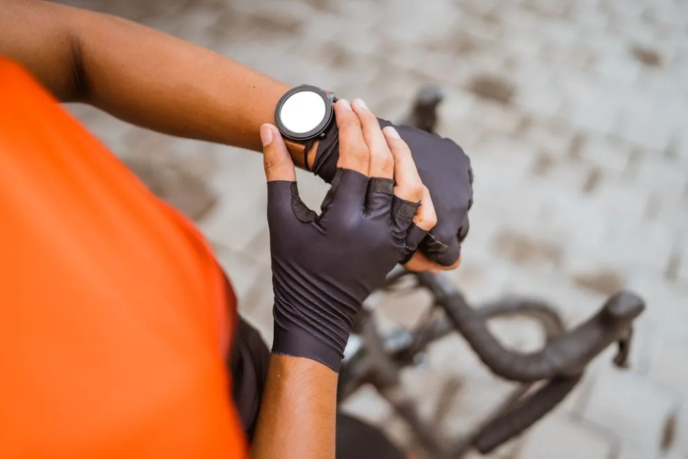
3) Smartwatch
A smartwatch is a great do-it-all fitness tracker. Depending on the watch, you can: record rides, upload and follow routes, monitor heart rate, listen to music, read messages and even make payments.
They can track a huge variety of sports and you can personalise the watch from your phone specific to your needs. You also won’t need a bike mount since it’s strapped to your wrist, nor will you need to remove it at cafe stops. However, this may make navigating not quite as easy as just looking down to your handlebars.
Due to their popularity, there is a number of brands making great smartwatches, including but not limited to: Wahoo, Garmin, Polar, Suunto, Fitbit, Samsung and Apple. Prices can, of course, vary greatly, depending on what you want out of your watch but it’s worth the investment if you’re committed to utilising a fitness tracker for great gains on your bike.
Once you’ve used your smartwatch for a ride, you can then save your activity and it will automatically be uploaded to the watch’s app as well as shared to any app you decide to use e.g. Strava.
4) Bike-mounted computers
The most dedicated of cycling technologies. Once upon a time, bike computers were cheap and cheerful, with the ability to calculate data from your ride to be saved for your personal enjoyment. Nowadays, they literally are like little computers attached to your bike, with a price-point to reflect this fact.
Not too dissimilar from a smartwatch in functionality, a bike computer will likely be rectangular shaped and mounted to your handlebars in an easily visible position making navigating a breeze whilst on the move. Similar to a watch, bike computers can vary in price depending on what you hope to use your bike computer for. So, the next question…
What should I look for when purchasing a device?
If mapping and navigation is your main reason for purchasing a smart device, then looking at those with good battery power will be of use since GPS drains batteries quicker than other functions. Wahoo and Garmin often come top when it comes to functioning for navigational purposes. This is also important if you plan to complete long-distance rides or multi-day rides without the ability to charge.
Alternatively, if you’re looking purely at data then sensor connections and connectivity of the device are important to get real-time data as well as things like a heart rate monitor and power functions.
As an additional point to remember, don’t forget that your computer or phone will need to be waterproof or have a waterproof cover – unless, of course, you live in a place that gets zero rain, in which case I’m quite jealous.