
It’s been a while since I tested myself on its challenging slopes. But as luck would have it, my schedule brought me near to its base. So I brought my bike along to give it another try. Here’s what it’s like to climb Mt. Ventoux.
The rating and weather
Mt. Ventoux, aka the Giant of Provence, falls into a distinguished league of climbs labelled “HC”. These letters stand for “Hors Catégorie” in French, or “beyond categorisation” when translated directly. An HC climb doesn’t fit into UCI’s typical classification process because of its length and slope.
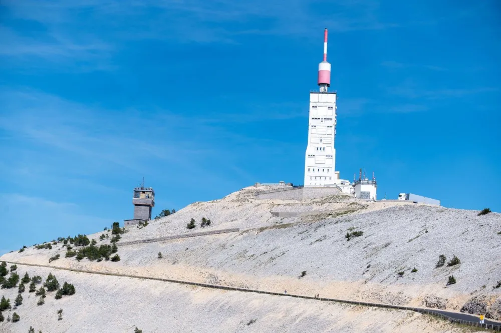
It can blow hard and cold on top of the Ventoux. The French word “vent” means wind in English. It’s the root of its name. Don’t attempt the climb if you can’t see the structure on top or if it’s already windy at the bottom.
The elevation on top is 1,910 m. It gets cold up there, even when temps below are clement or hot. Bring a jacket, vest, and maybe arm warmers too for the descent. It’s a long one and you’ll be soaked in sweat after the climb. Check your brakes as well; what goes up must come down.
Pick your side
There are three ways to reach the Ventoux summit by bicycle. Pick your starting point from the towns of Bédoin, Malaucène, or Sault. Malaucène is a separate route, but the Bédoin and Sault sides merge at the Chalet Reynard. Sault is the easiest of the three. It’s 4 km longer but the per cent gradient is more forgiving with 390 vertical metres fewer.
Sault is less challenging but once you get to Chalet Reynard, you’ve still got to make it to the top on the 8% average slope. Bédoin is the most typical route. If you want a real challenge, do all three in one day and join the “Club de Cinglés” or the Crazy Club.
From Bédoin
In Bédoin (309 m), I leave my car in the “Parking la Vigneronne”. It’s free and there’s a public toilet. And once you’re back, there are heaps of restaurants and cafes to celebrate your accomplishment. The tiny commune of Sainte Colombe (538 m) is 4 km up the road on the Route du Mont Ventoux (officially the D974). There’s a parking lot there, too, but I prefer starting in Bédoin for the additional warm-up and the public facilities.
One large water bottle should do the trick, unless it’s extremely hot. There’s a fountain at the Chalet Reynard, with 6 km to go, where you can refill it. If your jersey pockets are full, use your second water bottle cage to hold your warm clothing for the descent. And don’t forget the sunscreen.
As you leave the parking lot, follow the road (Avenue Barral des Baux) to the right that heads straight up and through the town of Bédoin. At the first round point, with the Bédoin Tourism office on your left, turn right here onto the Route du Mont Ventoux. You’re on your way. Follow its approximately 22 km to the top.
The road climbs gently as the Ventoux, skirted by neatly manicured rows of grapevines, looms in the distance on your left. It’s a safe bet these vines are red grapes with the “Côtes du Ventoux”, or the “Slopes of Ventoux” appellation. If you like reds, try it. The summit looks snow-capped. But it isn’t snow, most of the year that is. More on that later.
The forest
Follow the Mt Ventoux signs that lead you slightly left just after the commune of “Sainte Estève” (538 m). This is where you enter the forest and the road turns upward rudely. You’ll be riding on a 9.5% average for the next 9 km or so until you hit the Chalet Reynard. The maximum slope in this section is 11%.
The forest canopy provides valuable protection in the summer months, so enjoy the shade while you can if temps are high. Once you exit the forest, you are completely exposed to the elements. There are pesky flies too, attracted to the proteins and salt in your sweat. They come with the territory.
Markers are on the side of the road every kilometre. They show the current per cent grade and the remaining distance to the summit. If consuming gels or bars on the way, the mountain provides three giant garbage stations on the right as you climb. It’s almost impossible to miss when you throw, so use them.
The lunar landscape
The forest thins as you ascend and you leave it definitively behind, about 1 km from the Chalet Reynard (1,418 m). The summit is visible again now, with roughly 7 km remaining. Enjoy the next 4 km that are only 6%. It’s a chance for your legs to recover before the final push to the top.
You’re almost in the lunar landscape now and see what looks like snow from the valley floor is a crude, rugged landscape with no vegetation. The regular high winds don’t permit any roots to take hold. Locals call the Ventoux the “Mont Chauve” or the Bald Mountain because of it.
The summit is near but the final 3 km are merciless. You’re pedalling but don’t feel you’re getting any closer. With 1.5 km to go, pay your respects to Tom Simpson as you ride by (or on the descent). A memorial in his name stands on the right. Cyclists leave water bottles and objects as they pass. You’re almost at the top now. The final kilometre is a brutal 10% with a final tight right hairpin turn to arrive at the top (1,910 m).
Bravo! You successfully climbed 1,564 m in just under 22 km.
On top
Once on top, enjoy the 360° views. On a clear day, you can see Mont Blanc. There’s a small grocery store if you’re dying for a carbonated drink, coffee or a candy bar, but it’s only open in the summer months. The prices make your eyes water. I prefer to wait until I get back down.
In season and pleasant weather, an outdoor stand sells dried sausage and candy by weight. It can be crowded up there. Cyclists are joined by motorcycles and cars full of tourists that travel the easy way up to see the views. People congratulate you for making it to the top under your own power. Your picture under the summit sign is proof to share with your cycling friends.
The descent, gearing, and final thoughts
Once you’ve taken in the view, get ready for the descent. You might have your warm clothing on already. If you don’t, it’s time. You need it to protect yourself from the wind chill as you descend in sweaty clothes. Watch out for herds of sheep on the road and around corners as you go down.
You can reach some crazy speeds on the descent if that’s your thing. But proceed with caution. Depending on the time of year, the route is full of other hikers, riders and motorised vehicles. There aren’t any tight turns until you’re near the bottom, but the road isn’t closed and needs to be shared, safely, with others.
The gearing you choose depends on your fitness level and climbing abilities. I recommend at least a 34/30. A 32 would be optimal or even a 34 for some. How large you can go depends on the length of your rear derailleur cage. Your local bike professional can tell you if you aren’t sure.
The climb took me just over two hours; one of my better results. I’ve ridden the Ventoux eight times but this latest attempt was my favourite. The mid-October weather was fantastic, and the time of the year meant fewer riders and vehicles on the road. I felt I had the mountain to myself.
How long it takes isn’t important. Being outside, enjoying the views, the ride, and meeting the challenge of one of the most demanding climbs in France is reward enough. Markings on the road from Tours gone immerse you in the experience and bond you to the mountain. You’ll be back before you know it.